The Ohio Archaeological Inventory (OAI) is maintained by Ohio's State Historic Preservation Office (SHPO) and serves as the official record of all known prehistoric and historic archaeological sites in Ohio.
The OAI is used by the SHPO, and state, local, and federal agencies to assist with land-use planning, urban development, and road improvements. Decisions are often influenced by the presence of important archaeological sites, sometimes leading to project redesigns to avoid site destruction. Researchers and consultants also use the OAI as an archive and information resource.
Whether you are an archaeological consultant, academic researcher, or a public participant, you can play an important role in recording and preserving Ohio's archaeological history.
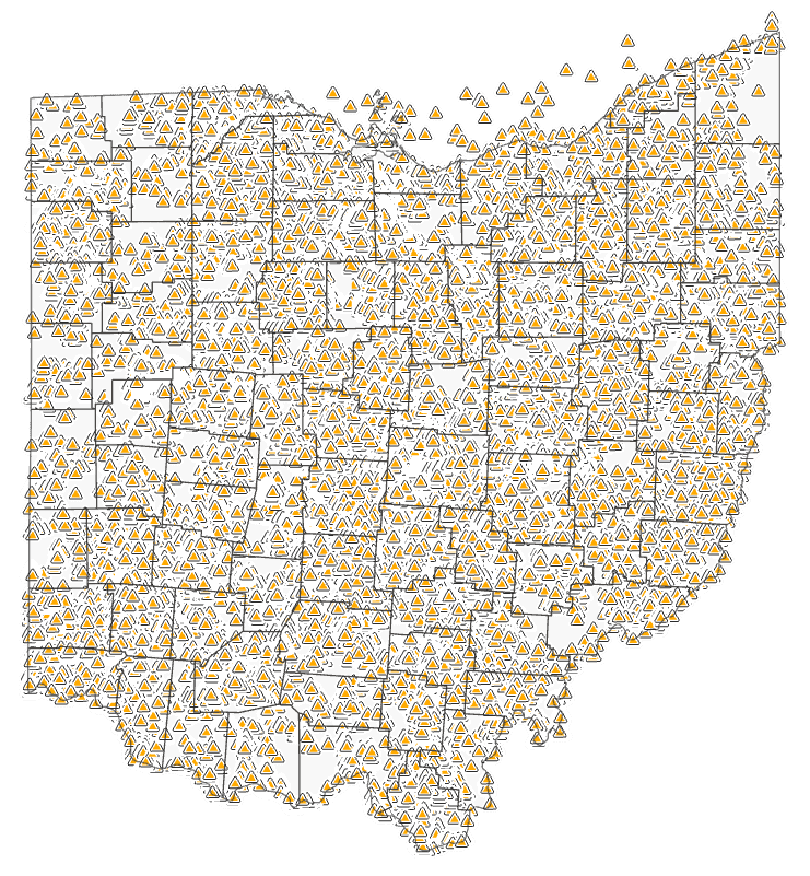
Section 106 of the National Historic Preservation Act and Section 149.30 of the Ohio Revised Code require the SHPO to maintain a statewide inventory of archaeological sites. Similarly, consultants must record sites identified during archaeological survey to the OAI.
To view inventoried sites and previously surveyed areas, subscribe to our Online Mapping System.
To request copies of OAI site forms and related survey reports, please Request SHPO Records.
Please note that all OAI forms are reviewed for accuracy by SHPO staff.
Connect with our Inventory & Registration Staff.
If a previously inventoried archaeological site has been re-identified during current fieldwork, please contact the Archaeology Survey & Data Manager to determine the best method to update the OAI form.
The Archaeology Survey & Data Manager will advise whether updates to existing sites should be submitted via a Revised Form or a Continuation Sheet. Revised Forms are completed within Survey123 while Continuation Sheets are submitted via email to the Archaeology Survey & Data Manager. For information on how to complete Continuation Sheets, please visit our Step-by-Step Guide.
The OAI, along with its supporting archival records and spatial data, is a valuable resource for academic and professional researchers, preservation consultants, and agency planning.
Qualified researchers are encouraged to begin their research by obtaining a Online Mapping System subscription. The Online Mapping System hosts data relating to inventoried archaeological sites and previously surveyed areas. To request copies of OAI site forms and related survey reports, please Request SHPO Records.
Researchers are encouraged to list new sites onto the OAI using Survey123, especially those identified or investigated outside the Section 106 process.
Per the federal Archaeological Resources Protection Act (PL 96-95), Freedom of Information Act (PL 89-554), and the National Historic Preservation Act (PL 89-665, 54 U.S.C. 300101), information regarding archaeological sites is restricted. Access to the OAI is limited to users who meet the Secretary of Interior's Professional Qualification Standards for Archaeology.
For more information on beginning research or to list sites onto the OAI, Contact Us or the Archaeology Survey & Data Manager.
The OAI contains over 60,000 archaeological sites, with over 1,000 new sites added each year!
Public members, including landowners and avocational archaeologists, have contributed over 1,000 sites to the OAI. To inventory a site, review our Guidelines on Reporting Archaeological Sites and carefully document the following details before Contacting Us:
For further guidance, see the Preliminary Documentation Form. If you need assistance from a professional archaeologist, the SHPO maintains a Consultants List of qualified professionals.
Visit our Cemetery Preservation webpage for information on preventing or reporting cemetery vandalism.
Before conducting investigations on state property, you must obtain permission from the relevant agency and a permit from the Ohio History Connection.
Collecting artifacts from federal property or private land without permission is illegal and can result in severe penalties under the Archaeological Resources Protection Act.
Inclusion in the OAI does not automatically register or nominate a property to the National Register of Historic Places. Sites listed to the OAI helps alert the preservation community, and local and state officials of the presence of Potentially Eligible sites.
Currently, 220 sites listed onto the OAI are also listed onto the National Register.
For more information on the nomination process, visit our National Register of Historic Places page.
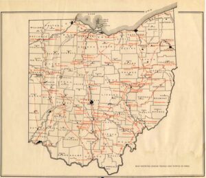
Archeological Atlas of Ohio (1914)
Early Inventory of Archaeological Sites
In 1895, Warren K. Moorehead, the first curator of the Ohio History Connection, began a comprehensive archaeological survey of Ohio. Moorehead documented over 3,000 mounds and earthworks during this time. The first female curator of the Ohio History Connection, Lucy Allen, continued documenting sites to the inventory in 1889. By 1914, William C. Mills published the results in the Archaeological Atlas of Ohio, identifying around 5,400 sites.
In the 1930s, curatorial assistant and Lithic Lab supervisor, H. H. Ellis, began to meticulously organize archaeological site documentation by county and plotted their locations on topographic maps. Until the 1950s, Ellis frequently made site visits to confirm the details and location of reported archaeological sites submitted by the public. His work laid the foundation for the formal Ohio Archaeological Inventory that we know today.
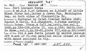
3x5" catalog card for Fort Ancient (33 WA 2)
Site Numbers: The Smithsonian Trinomial
Each site listed in the OAI receives a unique site number, formally known as a Smithsonian Trinomial. This numbering system was introduced in the early 20th century, during the federal archaeology projects of the Work Relief era, and continues to be used to identify archaeological sites by most SHPOs today.
Ohio History Connection archaeological curators at this time were able to use Ellis' site documentation and card catalog to begin assigning site numbers to confirmed archaeological sites in Ohio.
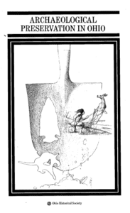
Front cover of SHPO's Archaeological Preservation in Ohio
The Ohio Archaeological Inventory
In 1966, the National Historic Preservation Act (NHPA) mandated the creation of SHPOs. The Ohio SHPO, headquartered in Columbus, Ohio, would come to have 11 regional satellite offices by 1978. Most regional offices were housed within universities, like Kent State University, Wright State University, and the University of Toledo.
In 1975 the Ohio SHPO formalized the organization of, and access to, OAI records. In 1978, the SHPO published Archaeological Preservation in Ohio. This publication introduced the official two-page OAI form. By early 1979 over 5,000 archaeological sites had been listed onto the OAI. The SHPO Archaeological Guidelines were revised in 1994, and shortly after, the Ohio Archaeological Inventory Instruction Manual was published in 1995. This manual introduced the ten-page OAI form and the Isolated Find form.
The OAI in the Digital Age
The pop-up login window for IForm
In 1988, a grant from the U.S. Army Corps of Engineers allowed SHPO to digitize over 17,000 OAI forms. In 1991, microfilming of the OAI and its associated 20,000 records began.
By 1998, the OAI was incorporated onto a GIS-based database, resulting in the MAPIT platform. Today, the Online Mapping System is used to facilitate access to all SHPO inventories.
IForm, the digital OAI and OHI form submission platform, was introduced in 2006 and was officially retired in 2023.
Today's Archaeological Inventory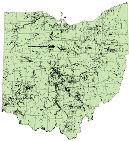
Following the retirement of IForm, the SHPO transitioned to using Esri’s Survey123 for OAI submissions. The OAI currently includes over 60,000 archaeological sites, with around 1,000 new sites added each year.
In addition to maintaining access to site documentation, the SHPO also retains copies of Section 106 reporting and other documents relating to the history of archaeological survey in Ohio.
Whether you are submitting OAI forms via Survey123, are an academic researching Ohio's archaeological sites, or a member of the public who is aware of an archaeological site - we are here to help you!
